
File:Almazán (Soria) Mapa.svg

Size of this PNG preview of this SVG file: 500 × 400 piksel. weerngooji: goɗɗi 300 × 240 piksel | 600 × 480 piksel | 960 × 768 piksel | 1 280 × 1 024 piksel | 2 560 × 2 048 piksel.
Fiilde asliire (Fiilde SVG, werngo mum ko 500 × 400 pikelle, ɓetol fiildee: 200 KB)
_Mapa.svg)
Tonngol
| Cifagol |
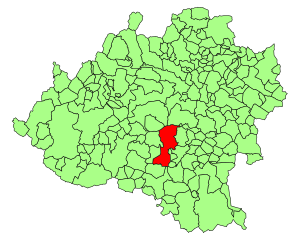
Español: Situación de Almazán en la provincia de Soria (España) |
| Ñalngu | 2 Seeɗto 2007 (upload date) |
| Sewnde | Version de Image:Soria - Mapa municipal.svg de User:Tony Rotondas |
| Binnduɗo | Nueva versión de User:HiTe |
| Jamirol (Kuuttoragol ndee fiilde) |
GFDL |
| Other versions | Image:Soria - Mapa municipal.svg |
Jamirooje
| I, the copyright holder of this work, release this work into the public domain. This applies worldwide. In some countries this may not be legally possible; if so: I grant anyone the right to use this work for any purpose, without any conditions, unless such conditions are required by law. |
Aslol fiilde
Dobo e ñalngu/waktu ngam yiyde fiilde ndee no nde yaltirta e oon waktu nih.
| Ñalngu/Waktu | Dooɓre | Ɓete | Kuutoro | Yowre | |
|---|---|---|---|---|---|
| gonaaɗo | 18:29, 2 Seeɗto 2007 | | 500 × 400 (200 KB) | HiTe~commonswiki | {{Information| |Description= {{es| Mapas de municipios de la provincia de Soria}} |Source= Version de Image:Soria - Mapa municipal.svg de User:Tony Rotondas |Date= 2-4-2007 |Author= Nueva versión de User:HiTe |Permission= GFDL |other_version |
Kuutorgol fiilde
Ngoo hello ena huutoroo ndee fiilde:
Kuutoragol fiilde kuuɓtidinngol
Wikiiji ɗii-ɗoo goɗɗi ena kuutoroo ndee fiilde:
- Kuutoragol e ace.wikipedia.org
- Kuutoragol e ang.wikipedia.org
- Kuutoragol e arc.wikipedia.org
- Kuutoragol e ar.wikipedia.org
- Kuutoragol e arz.wikipedia.org
- Kuutoragol e ast.wikipedia.org
- Kuutoragol e ay.wikipedia.org
- Kuutoragol e azb.wikipedia.org
- Kuutoragol e ba.wikipedia.org
- Kuutoragol e bcl.wikipedia.org
- Kuutoragol e bi.wikipedia.org
- Kuutoragol e br.wikipedia.org
- Kuutoragol e ca.wikipedia.org
- Kuutoragol e cbk-zam.wikipedia.org
- Kuutoragol e ceb.wikipedia.org
- Kuutoragol e ch.wikipedia.org
- Kuutoragol e co.wikipedia.org
- Kuutoragol e csb.wikipedia.org
- Kuutoragol e da.wikipedia.org
- Kuutoragol e diq.wikipedia.org
- Kuutoragol e dv.wikipedia.org
- Kuutoragol e el.wikipedia.org
- Kuutoragol e eml.wikipedia.org
- Kuutoragol e en.wikipedia.org
- Kuutoragol e eo.wikipedia.org
- Kuutoragol e et.wikipedia.org
- Kuutoragol e eu.wikipedia.org
- Kuutoragol e fa.wikipedia.org
- Kuutoragol e fiu-vro.wikipedia.org
- Kuutoragol e fi.wikipedia.org
- Kuutoragol e frp.wikipedia.org
- Kuutoragol e fr.wikipedia.org
- Kuutoragol e fur.wikipedia.org
- Kuutoragol e gag.wikipedia.org
- Kuutoragol e gd.wikipedia.org
- Kuutoragol e gl.wikipedia.org
- Kuutoragol e hak.wikipedia.org
- Kuutoragol e haw.wikipedia.org
- Kuutoragol e hsb.wikipedia.org
- Kuutoragol e ht.wikipedia.org
- Kuutoragol e hu.wikipedia.org
- Kuutoragol e hy.wikipedia.org
- Kuutoragol e ia.wikipedia.org
- Kuutoragol e id.wikipedia.org
- Kuutoragol e ie.wikipedia.org
- Kuutoragol e incubator.wikimedia.org
Yiy jokkol kuutoragol kuuɓtidingol ngoo hello.
_Mapa.svg)
_Mapa.svg)