
File:MinasGerais Municip CoronelFabriciano.svg

Fiilde asliire (Fiilde SVG, werngo mum ko 2 147 × 1 723 pikelle, ɓetol fiildee: 2,9 MB)

|
Standardization of derivative maps
Feel free to create derivations of this work, but if you want to illustrate a Wikipedia article with derivative works of this or similar maps of Brazil, please strictly follow the visual standard, nomenclature and classification already in use. All maps of Brazilian subdivisions are being adaptated or created in this way. We do not want to inhibit creativity but the pattern adopted here was presented and accepted by the Lusophone community and should be followed whenever possible. |
Tonngol
| Cifagol |
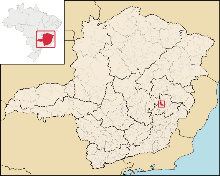
English: Location map of the municipality of Coronel Fabriciano in Minas Gerais state, Brazil.
Português: Localização do município de Coronel Fabriciano no estado de Minas Gerais, Brasil. |
| Ñalngu | |
| Sewnde | File:Brazil Minas Gerais location map.svg (derivate for File:MinasGerais MesoMicroMunicip.svg) |
| Binnduɗo |
Jamirooje
- Aɗa wellitii:
- e lollinde – e tummbitaade, saakde e ɓenninde golle ɗee
- e muultaade – e jaaɓtinde
- E ɗii-ɗoo sarɗiiji:
- fe'inana – You must give appropriate credit, provide a link to the license, and indicate if changes were made. You may do so in any reasonable manner, but not in any way that suggests the licensor endorses you or your use.
Aslol fiilde
Dobo e ñalngu/waktu ngam yiyde fiilde ndee no nde yaltirta e oon waktu nih.
| Ñalngu/Waktu | Dooɓre | Ɓete | Kuutoro | Yowre | |
|---|---|---|---|---|---|
| gonaaɗo | 18:13, 29 Korse 2020 | | 2 147 × 1 723 (2,9 MB) | Apollo BR | Atualização das mesorregiões e microrregiões de Minas Gerais para regiões geográficas intermediárias e regiões geográficas imediatas, respectivamente, segundo nova classificação do IBGE de 2017. Fonte: IBGE 2017 <https://www.ibge.gov.br/apps/regioes_geograficas/> Base Cartográfica: IBGE 2019 <https://www.ibge.gov.br/geociencias/organizacao-do-territorio/15774-malhas.html?=&t=downloads> Elaboração: Trabalho próprio, com o software QGIS. Formatação das camadas: MINAS GERAIS: borda= 0,66 mm... |
| 22:59, 29 Bowte 2018 |  | 914 × 709 (2,43 MB) | HVL | Removing regional division extinguished | |
| 04:45, 28 Juko 2006 |  | 914 × 709 (1,91 MB) | Raphael.lorenzeto | {{Information| |Description=Map locator of a city in Minas Gerais (this description will be changed) |Source=Image:MinasGerais MesoMicroMunicip.svg, own work |Date=August 28, 2006 |Author=Raphael Lorenzeto de Abreu |Permission={{self2|GFDL|cc-by-2.5} |
Kuutorgol fiilde
Ngoo hello ena huutoroo ndee fiilde:
Kuutoragol fiilde kuuɓtidinngol
Wikiiji ɗii-ɗoo goɗɗi ena kuutoroo ndee fiilde:
- Kuutoragol e ar.wikipedia.org
- Kuutoragol e bcl.wikipedia.org
- Kuutoragol e bpy.wikipedia.org
- Kuutoragol e ca.wikipedia.org
- Kuutoragol e ch.wikipedia.org
- Kuutoragol e de.wikipedia.org
- Kuutoragol e en.wikipedia.org
- Kuutoragol e eo.wikipedia.org
- Kuutoragol e es.wikipedia.org
- Kuutoragol e eu.wikipedia.org
- Kuutoragol e fa.wikipedia.org
- Kuutoragol e fj.wikipedia.org
- Kuutoragol e gl.wikipedia.org
- Kuutoragol e ha.wikipedia.org
- Kuutoragol e hr.wikipedia.org
- Kuutoragol e ia.wikipedia.org
- Kuutoragol e id.wikipedia.org
- Kuutoragol e incubator.wikimedia.org
- Kuutoragol e io.wikipedia.org
- Kuutoragol e it.wikipedia.org
- Kuutoragol e kaa.wikipedia.org
- Kuutoragol e ko.wikipedia.org
- Kuutoragol e la.wikipedia.org
- Kuutoragol e lg.wikipedia.org
- Kuutoragol e ms.wikipedia.org
- Kuutoragol e mt.wikipedia.org
- Kuutoragol e mwl.wikipedia.org
- Kuutoragol e nl.wikipedia.org
- Kuutoragol e nn.wikipedia.org
- Kuutoragol e nov.wikipedia.org
- Kuutoragol e no.wikipedia.org
- Kuutoragol e oc.wikipedia.org
- Kuutoragol e pt.wikipedia.org
- Kuutoragol e pt.wikibooks.org
- Kuutoragol e ro.wikipedia.org
- Kuutoragol e sh.wikipedia.org
- Kuutoragol e simple.wikipedia.org
- Kuutoragol e sm.wikipedia.org
- Kuutoragol e ss.wikipedia.org
- Kuutoragol e sv.wikipedia.org
- Kuutoragol e tt.wikipedia.org
- Kuutoragol e uk.wikipedia.org
- Kuutoragol e vi.wikipedia.org
- Kuutoragol e vo.wikipedia.org
Yiy jokkol kuutoragol kuuɓtidingol ngoo hello.