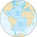
File:Atlantic Ocean - en.png
Atlantic_Ocean_-_en.png (328 × 328 piksele, ɓetol fiilde: 12 KB, mbaydi MIME: image/png)
Aslol fiilde
Dobo e ñalngu/waktu ngam yiyde fiilde ndee no nde yaltirta e oon waktu nih.
| Ñalngu/Waktu | Dooɓre | Ɓete | Kuutoro | Yowre | |
|---|---|---|---|---|---|
| gonaaɗo | 16:44, 5 Colte 2024 |  | 328 × 328 (12 KB) | Janitoalevic | . |
| 16:23, 31 Juko 2015 |  | 328 × 328 (12 KB) | Wmq | Reverted to version as of 20:21, 22 August 2009 - wrong bot edit | |
| 12:24, 29 Juko 2015 |  | 328 × 328 (12 KB) | SteinsplitterBot | Bot: Image rotated by 180° | |
| 20:21, 22 Juko 2009 |  | 328 × 328 (12 KB) | Serg!o | {{original||2004 version}} == {{int:filedesc}} == {{Information |Description=North and South Atlantic Ocean |Source= [https://www.cia.gov/library/publications/the-world-factbook/geos/zh.html CIA World Factbook - Atlantic Ocean] ([https://www.cia.gov/l |
Kuutorgol fiilde
Alaa kelle kuutotooɗe ndee fiilde.
Kuutoragol fiilde kuuɓtidinngol
Wikiiji ɗii-ɗoo goɗɗi ena kuutoroo ndee fiilde:
- Kuutoragol e ace.wikipedia.org
- Kuutoragol e am.wikipedia.org
- Kuutoragol e as.wikipedia.org
- Kuutoragol e az.wikipedia.org
- Kuutoragol e bcl.wikipedia.org
- Kuutoragol e bh.wikipedia.org
- Kuutoragol e blk.wikipedia.org
- Kuutoragol e bn.wikipedia.org
- Kuutoragol e ca.wikipedia.org
- Kuutoragol e cdo.wikipedia.org
- Kuutoragol e dty.wikipedia.org
- Kuutoragol e en.wikipedia.org
- Kuutoragol e en.wikibooks.org
- Kuutoragol e en.wikinews.org
- Kuutoragol e en.wikiquote.org
- Kuutoragol e en.wikisource.org
- Kuutoragol e en.wikiversity.org
- Kuutoragol e eo.wikipedia.org
- Kuutoragol e eo.wiktionary.org
- Kuutoragol e eu.wikipedia.org
- Kuutoragol e fi.wikipedia.org
- Kuutoragol e fi.wiktionary.org
- Kuutoragol e gu.wikipedia.org
- Kuutoragol e haw.wikipedia.org
- Kuutoragol e ht.wikipedia.org
- Kuutoragol e hy.wikipedia.org
- Kuutoragol e ilo.wikipedia.org
- Taaw Atlantiko
- Wikipedia:Napili nga artikulo ita nga aldaw/Abril 5
- Wikipedia:Napili nga artikulo ita nga aldaw/Mayo 20
- Wikipedia:Napili nga artikulo ita nga aldaw/Hulio 4
- Wikipedia:Napili nga artikulo ita nga aldaw/Agosto 18
- Wikipedia:Napili nga artikulo ita nga aldaw/Oktubre 2
- Wikipedia:Napili nga artikulo ita nga aldaw/Nobiembre 16
- Wikipedia:Napili nga artikulo ita nga aldaw/Disiembre 31
- Wikipedia:Napili nga artikulo ita nga aldaw/Pebrero 14
- Kuutoragol e incubator.wikimedia.org
- Kuutoragol e is.wikipedia.org
- Kuutoragol e kaa.wikipedia.org
- Kuutoragol e kcg.wikipedia.org
- Kuutoragol e ku.wikipedia.org
- Kuutoragol e la.wikipedia.org
Yiy jokkol kuutoragol kuuɓtidingol ngoo hello.


