
File:Borgu.jpeg
Werngo ɓurngo ɗoo toowde alaa.
Borgu.jpeg (614 × 376 piksele, ɓetol fiilde: 167 KB, mbaydi MIME: image/jpeg)
Tonngol
| Cifagol |
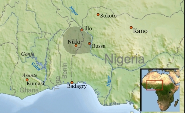
Nederlands: Kaart ligging Borgoe in W-Afrika |
| Ñalngu |
19 Duujal 2008 (original upload date) |
| Sewnde | Bewerkt van File:Africa_topography_map_with_borders.png en File:Africa_satellite_orthographic.jpg |
| Binnduɗo |
The original uploader was Rollebon at Dacceere Wikipeediya. |
| Jamirol (Kuuttoragol ndee fiilde) |
GNU. Voor de inset : " public domain because it was created by NASA. NASA copyright policy states that "NASA material is not protected by copyright unless noted"" |
Jamirooje

|
Permission is granted to copy, distribute and/or modify this document under the terms of the GNU Free Documentation License, Version 1.2 or any later version published by the Free Software Foundation; with no Invariant Sections, no Front-Cover Texts, and no Back-Cover Texts. A copy of the license is included in the section entitled GNU Free Documentation License. |
| This file is licensed under the Creative Commons Attribution-Share Alike 3.0 Unported license. | ||
| ||
| This licensing tag was added to this file as part of the GFDL licensing update. |
Original upload log
Transferred from nl.wikipedia to Commons by GijsvdL using CommonsHelper.
The original description page was here. All following user names refer to nl.wikipedia.
- 2008-05-19 19:58 Rollebon 612×376×8 (176604 bytes) {{Information |Description=Kaart Borgoe in W-Afrike |Source=Bewerkt van http://commons.wikimedia.org/wiki/Image%3AAfrica_topography_map_with_borders.png en http://commons.wikimedia.org/wiki/Image:Africa_satellite_orthographic.jpg |Date=19052008 |Author=Wi
Aslol fiilde
Dobo e ñalngu/waktu ngam yiyde fiilde ndee no nde yaltirta e oon waktu nih.
| Ñalngu/Waktu | Dooɓre | Ɓete | Kuutoro | Yowre | |
|---|---|---|---|---|---|
| gonaaɗo | 22:12, 3 Korse 2008 | | 614 × 376 (167 KB) | Oliphaunt | actualisation |
| 23:46, 19 Duujal 2008 |  | 612 × 376 (172 KB) | GijsvdL | {{Information |Description={{nl|Kaart ligging Borgoe in W-Afrika}} |Source=Transferred from [http://nl.wikipedia.org nl.wikipedia]; transfered to Commons by User:GijsvdL using [http://tools.wikimedia.de/~magnus/commonshelper.php CommonsHelper].<br/> ( |
Kuutorgol fiilde
Ngoo hello ena huutoroo ndee fiilde:
Kuutoragol fiilde kuuɓtidinngol
Wikiiji ɗii-ɗoo goɗɗi ena kuutoroo ndee fiilde:
- Kuutoragol e cs.wikipedia.org
- Kuutoragol e de.wikipedia.org
- Kuutoragol e en.wikipedia.org
- Kuutoragol e es.wikipedia.org
- Kuutoragol e fr.wikipedia.org
- Kuutoragol e gl.wikipedia.org
- Kuutoragol e ha.wikipedia.org
- Kuutoragol e ig.wikipedia.org
- Kuutoragol e it.wikipedia.org
- Kuutoragol e ja.wikipedia.org
- Kuutoragol e lt.wikipedia.org
- Kuutoragol e nl.wikipedia.org
- Kuutoragol e pt.wikipedia.org
- Kuutoragol e www.wikidata.org
- Kuutoragol e zh.wikipedia.org