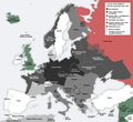
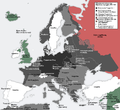
File:Europe under Nazi domination.png
Appearance

Ɓetol ngol jiytol: 654 × 600 piksel. weerngooji: goɗɗi 262 × 240 piksel | 523 × 480 piksel | 837 × 768 piksel | 1 088 × 998 piksel.
Fiilde asliire (1 088 × 998 piksele, ɓetol fiilde: 187 KB, mbaydi MIME: image/png)
Aslol fiilde
Dobo e ñalngu/waktu ngam yiyde fiilde ndee no nde yaltirta e oon waktu nih.
| Ñalngu/Waktu | Dooɓre | Ɓete | Kuutoro | Yowre | |
|---|---|---|---|---|---|
| gonaaɗo | 11:43, 23 Siilo 2015 |  | 1 088 × 998 (187 KB) | DIREKTOR | Fixed error in Thrace: Germany occupied a strip of Greek territory at the border with Turkey. |
| 10:54, 22 Siilo 2015 |  | 1 088 × 998 (187 KB) | DIREKTOR | Fixed error at Crete. | |
| 09:30, 22 Siilo 2015 |  | 1 088 × 998 (187 KB) | DIREKTOR | Added brackets "(Under Military Admin.)", and capitalized "Z" in "zone". | |
| 00:10, 22 Siilo 2015 |  | 1 088 × 998 (187 KB) | DIREKTOR | Restored Vichy France label. | |
| 21:46, 21 Siilo 2015 |  | 1 088 × 998 (187 KB) | DIREKTOR | Small label fix. | |
| 21:42, 21 Siilo 2015 |  | 1 088 × 998 (187 KB) | DIREKTOR | "Reichskommissariat Niederlande" -> "RK Niederlande" | |
| 21:41, 21 Siilo 2015 |  | 1 088 × 998 (188 KB) | DIREKTOR | Further fixes and modifications: the Netherlands were not a Nazi co-belligerent: replaced "Netherlands" with "Reichskommissariat Niederlande"; Denmark was not formally occupied by 1941-42; introduced uniform labels for territories under military occupa... | |
| 16:30, 11 Yarkomaa 2014 |  | 1 088 × 998 (187 KB) | DIREKTOR | "Norway" -> "Reichskommissariat Norwegen" | |
| 15:14, 11 Yarkomaa 2014 |  | 1 088 × 998 (186 KB) | DIREKTOR | "Greece" replaced with "Italian military admin." + fixed caption in accordance with previous modification. | |
| 14:57, 11 Yarkomaa 2014 |  | 1 088 × 998 (186 KB) | DIREKTOR | Modified to depict German-occupied territory differently than that by other Axis countries + brightened Vichy France, given the period. |
Kuutorgol fiilde
Ngoo hello ena huutoroo ndee fiilde:
Kuutoragol fiilde kuuɓtidinngol
Wikiiji ɗii-ɗoo goɗɗi ena kuutoroo ndee fiilde:
- Kuutoragol e ar.wikipedia.org
- Kuutoragol e arz.wikipedia.org
- Kuutoragol e en.wikipedia.org
- Kuutoragol e ku.wikipedia.org
- Kuutoragol e la.wikipedia.org
- Kuutoragol e mk.wikipedia.org
- Kuutoragol e pt.wikipedia.org
- Kuutoragol e vi.wikipedia.org


