
File:Oceania satellite map.jpg

Ɓetol ngol jiytol: 600 × 600 piksel. weerngooji: goɗɗi 240 × 240 piksel | 480 × 480 piksel | 900 × 900 piksel.
Fiilde asliire (900 × 900 piksele, ɓetol fiilde: 451 KB, mbaydi MIME: image/jpeg)
Tonngol
| Cifagol |
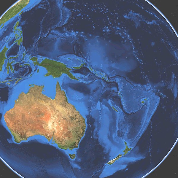
English: Satellite map of Oceania. Land terrain and bathymetry (ocean-floor topography). |
| Ñalngu | |
| Sewnde | Own work by uploader, made with NASA World Wind. |
| Binnduɗo | Koyos |
| Other versions |
|


Jamirooje
| I, the copyright holder of this work, release this work into the public domain. This applies worldwide. In some countries this may not be legally possible; if so: I grant anyone the right to use this work for any purpose, without any conditions, unless such conditions are required by law. |
Aslol fiilde
Dobo e ñalngu/waktu ngam yiyde fiilde ndee no nde yaltirta e oon waktu nih.
| Ñalngu/Waktu | Dooɓre | Ɓete | Kuutoro | Yowre | |
|---|---|---|---|---|---|
| gonaaɗo | 03:45, 15 Mbooy 2009 | | 900 × 900 (451 KB) | Koyos | {{Information |Description={{en|1=Satellite map of Oceania. Terrain and ocean topography.}} |Source=Own work by uploader |Author=Koyos |Date=2009-03-15 |Permission= |other_versions= }} <!--{{ImageUpload|full}}--> [[Category:Geography of Oc |
Kuutorgol fiilde
10 Ɗee kelle ena kuutoroo ndee fiilde:
Kuutoragol fiilde kuuɓtidinngol
Wikiiji ɗii-ɗoo goɗɗi ena kuutoroo ndee fiilde:
- Kuutoragol e ba.wikipedia.org
- Kuutoragol e eo.wikipedia.org
- Kuutoragol e es.wikipedia.org
- Kuutoragol e et.wikipedia.org
- Kuutoragol e eu.wikipedia.org
- Kuutoragol e fr.wikipedia.org
- Kuutoragol e it.wiktionary.org
- Kuutoragol e lmo.wikipedia.org
- Kuutoragol e oc.wikipedia.org
- Kuutoragol e sv.wikipedia.org
- Oceanien
- Kategori:1956 i Oceanien
- Kategori:1938 i Oceanien
- Kategori:1937 i Oceanien
- Kategori:1901 i Oceanien
- Kategori:2000 i Oceanien
- Kategori:2010 i Oceanien
- Kategori:1964 i Oceanien
- Kategori:1970 i Oceanien
- Kategori:1988 i Oceanien
- Kategori:1990 i Oceanien
- Kategori:1965 i Oceanien
- Kategori:1966 i Oceanien
- Kategori:1967 i Oceanien
- Kategori:1968 i Oceanien
- Kategori:1969 i Oceanien
- Kategori:1971 i Oceanien
- Kategori:1972 i Oceanien
- Kategori:1973 i Oceanien
- Kategori:1974 i Oceanien
- Kategori:1975 i Oceanien
- Kategori:1976 i Oceanien
- Kategori:1985 i Oceanien
- Kategori:1986 i Oceanien
- Kategori:1987 i Oceanien
- Kategori:1989 i Oceanien
- Kategori:1991 i Oceanien
- Kategori:1992 i Oceanien
- Kategori:1993 i Oceanien
- Kategori:1994 i Oceanien
- Kategori:1995 i Oceanien
- Kategori:1996 i Oceanien
- Kategori:1997 i Oceanien
- Kategori:1998 i Oceanien
- Kategori:1999 i Oceanien
- Kategori:2001 i Oceanien
- Kategori:2002 i Oceanien
- Kategori:2003 i Oceanien
- Kategori:2004 i Oceanien
- Kategori:2005 i Oceanien
- Kategori:2006 i Oceanien
Yiy jokkol kuutoragol kuuɓtidingol ngoo hello.