Maayo Ɓaleejo (Jamayka)
| Mouth of the watercourse | Caribbean Sea |
|---|---|
| Lesdi | Jamayka |
| Nder laamoore | Saint Elizabeth Parish |
| Jonde kwa'odineto | 18°1′18″N 77°50′49″W, 18°11′23″N 77°41′0″W, 18°1′18″N 77°50′49″W |
| Heritage designation | Ramsar site |
Maayo Black (Maayo ɓaleejo) ina jeyaa e maayooji ɓurɗi juutde e nder leydi Jamayka. E njuuteendi 53,4 km (33,2 mi),[1] ina sikkaa ko kañum ɓuri juutde haa yiytaa wonde Rio Minho ina waɗi 92,8 km.[2] Innde mayre ina firta niɓɓere ɓuuɓnde maayo nde laabi tedduɗi ɓuuɓɗi ɓuuɓɗi ngaddata.
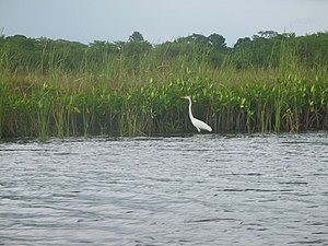
Ko ɓuri 100 mbaydi colli njiytaama e nder ŋoral maayo ɓaleejo.[3] Nokku 17 769 ha e nder maayo ngoo, ina hawra e ko ɓuri heewde e Morass toowɗo e les, ko BirdLife International toɗɗii ɗum nokku colli teeŋtuɗo (IBA) sabu ina wallita e keewal colli Jamayka keewɗi.
Joogaraafi
[taƴto | taƴto ɗaɗi wiki]Fooyre
[taƴto | taƴto ɗaɗi wiki]Fuɗɗoode maayo ngoo ko Leydi Kokpit ɗo ngo dogata les leydi hade maggo yaltude to fuɗnaange Siloah e dow ŋoral Kokpit (18°11′22′′N 77°41′00′′W / 18.1895534°3N 77.693[07.63]W). Caggal nde maggal ummii ɗoon e ɗoon, maayo ngoo ina ɓuuɓtoo no feewi e nder gese canngaaki e nder Estaad Appleton. Nde heɓata ko doole ummoraade e maayo One Eye, ko jokkondiral maayo Hectors ɓurngo mawnude ngo waɗi keeri Trelawny e Manchester. E ɓadtaade Maggotty, njaaweeki mum ina ɓeydoo, sahaa e sahaa fof ina waɗa jaawle.[4] Rewde e Maggotty, maayo ngoo ina doga e sara laawol ngol, ina jippoo e ɓulli tokoosi keewɗi e ɓulli maayo ɓaleejo, tawaaɗi e nder nokku biyeteeɗo Apple Valley Park.[4]
Upper Morass
[taƴto | taƴto ɗaɗi wiki]Ɓaawo Newton, maayo ɗon ɓooydi haa Upper Morass ɗon hawta bee maayo Smith e kookooji ɗi ɓurɗi ɓooyɗe, ɗo ɓooyɗi ɓoowɗi ɗon ɓoyi.[4] Nder nokkuure Elim, duɗal kalkooje ɗon mawnina 'kalkooje Yeesu,' feere feere nder kalkooje afrik,[5] ɗum noddetee ngam anndal maako bana ko'e kalkooje. Jacana anndiraa kadi nder nokkuure nde 'Yesu bird,' ngam o hokkata no o ɗon yaha dow ndiyam to o ɗon yaawdi caka leɗɗe ndiyam.
Lacovia e Middle Quarters ɗon hawrata hakkunde Upper Morass e Lowre Morass.[4] Middle Quarters ɗon anndina ngam cankolji maako, anndiraaɓe nder nokkuure maako bana 'kaɓɓolji cankol". Caɗeele ɗe ngaɗolɓe mbaɗol naftora no ɗe nder maayo Niger nder Afirka; anndal waɗugo ɗe ɓe njottini haa saare nde maccuɓe ɓurɓe duuɓi 300 ɓaawo.
Lowre Morass
[taƴto | taƴto ɗaɗi wiki]Lowre Morass ina woodi ko'e mum'en, ko'e marshland e mangrove swamps, ko'en ɗon hokkata babal babal babal babal foroy ngam leƴƴi, colli e goɗɗe leeɓɗe hawti e lobsters, mangrove snappers, snook e mullet. Ɗoon maayo ɗon hawta bee maayo YS[4] waɗi Lower Morass ɓurɗo mawnugo (14,085 ektaar) babal babal babal nder Kariibi.
Kookodol Amerik (Crocodylus acutus) jooɗori nder kookol, amma yimɓe ɓe ɗon ɓeyda, ngam ɓe ɗon maaya nokkuuje maɓɓe ngam ɓe ɗon mari ɓeydaare ngam ɓe ɗon njaɓa ko'e maɓɓe ngam ɓe mbaɗa bee ko'e ɗi ɓe mbaɗa. Ɗe colli ɗon hawta ɗo hawti e geese, geese e geese. Leɗɗe mangrove nder Lower Morass ɗon laatiiji booji ɗon laatiije bee ko'e ndiyam ɗi ɗon sendina bana leɗɗe njoggo, nden wakkati feere ɗon wurtina 40 ft (12 nder maayo.
Ɗuumol
[taƴto | taƴto ɗaɗi wiki]Fedde ndee ina wona haa maayo (18°01′18′′N 77°50′49′′W / 18.021624°N 77.846949°W / 18.02.1624; -77.846949) e fuɗnaange fuɗnaande wuro nanondirɗo e innde ndee.[4]
Kuutol jaaynde
[taƴto | taƴto ɗaɗi wiki]Sahaa, wood wood tree trunks wonti yahugo dow maayo Black to port ngam yahugo to Ingiltere ngam waɗugo dyes. Jooni, boote motorooje ɗon njaha turista'en nder nder nder gariiri Black River haa nder nder nder lesdi.
Firooji
[taƴto | taƴto ɗaɗi wiki]- ↑ "Jamaica Black River, About the River". Retrieved 7 December 2012.
- ↑ Jamaica National Heritage Trust - Black River Template:Webarchive
- ↑ Jamaica National Heritage Trust - Black River Template:Webarchive
- ↑ 4.0 4.1 4.2 4.3 4.4 4.5 UK Directorate of Overseas Surveys 1:50,000 map of Jamaica sheet D, 1959.
- ↑ Fishbase.org

