
Togo

| Yemre | West Africa |
|---|---|
| Golle imaaɗe | 27 Seeɗto 1960 |
| Laamu innde | Togo, Togo, République togolaise |
| Lesdinkeejum | Togo |
| Mutiɗa innde | 🇹🇬 |
| Ɗemngal ngal sarwiisiiji leydi fu njoni haalude | Faransinkoore |
| Doondo leydi | Terre de nos aïeux |
| Tagu | culture of Togo |
| Jammoore leydi | Travail, Liberté, Patrie, Work, Liberty, Homeland, Труд, свобода, Родина, Treball, llibertat, pàtria, Gwaith, rhyddid, mamwlad |
| Duungal | Afirik |
| Lesdi | Togo |
| Laamorde | Lomé |
| Hiiri-weeti pelle | UTC±00:00, Africa/Lome |
| Located in or next to body of water | Atalantika |
| Annditirɗum | West Africa |
| Jonde kwa'odineto | 8°15′0″N 1°11′0″E |
| Kwa'odineto lettugal | 6°17′16″N 1°48′30″E |
| Soɓɓire | 11°8′22″N 0°8′10″W |
| Horɗoore | 6°6′44″N 1°11′59″E |
| Gorgal | 11°8′22″N 0°8′10″W |
| Towendi | Mount Agou |
| Hoɓade | Bight of Benin |
| Birrol parti politikki | President of Togo |
| Arɗiiɗo lesdi | Faure Essozimna Gnassingbé |
| Office held by head of government | Prime Minister |
| Hooreejo leydi | Victoire Dogbé Tomegah |
| Laamu battaa en | Government of Togo |
| Laamu depitee en | National Assembly |
| Central bank | Central Bank of West African States |
| Ndewgu | Savanes Region, Kara Region, Centrale Region, Maritime, Plateaux Region |
| Cede | West African CFA franc |
| Shares border with | Burkina Faso, Gana, Benen, Hohoe |
| Driving side | right |
| Electrical plug type | Europlug |
| Follows | French Togoland |
| Studied in | Togolese studies |
| Laawol ngol laamu anndani | https://www.republicoftogo.com |
| Hashtag | Togo |
| Golle gofernema | .tg |
| Deesewal | Flag of Togo |
| Coat of arms | Emblem of Togo |
| Joogarafii | geography of Togo |
| Has characteristic | partly free country |
| Taariki | history of Togo |
| Ndesa | economy of Togo |
| Annaji Aljeri | demographics of Togo |
| Mobile country code | 615 |
| Country calling code | +228 |
| Emergency phone number | 118, 117, 171, 172 |
| Licence plate code | TG |
| Maritime identification digits | 671 |
| Unicode character | 🇹🇬 |
| Category for maps or plans | Category:Maps of Togo |

Togo ko hawtugo Togo (e wolde Faransako’en Republique Togoloise), lesdi e der lesde de lardiwal Afrik kayri ndi heeɓi ardungal maari e dumngu 1960 less Faransi. Togo haa nɗi woodi (mari) nJayri ɗudɗi bano kilomita 56,785km be adadu yimɓe yahri banoo 7,552,318 e faro lingal 2015.[1] Togo ɗi wadi kerole lesde Liberiya, Gini, Mali, Burkina Faso e ɗen Gaana fu galle mawɗe e to kaanje goni lome. Togo ko leydi e Afirik. Mbertudi leydi ndin ko 56.785 km2, yimmɓe hoɗuɗo e mayri no hewtaynoo fewndo hitaande 2013 yimɓe 7.154.237. Laamorde nden ko Lome.[2][3]
Keɓe Lesdi Anngola
[taƴto | taƴto ɗaɗi wiki]| Region | Capital | Zone | Area (km2) [4] |
Population (2010 census) |
Prefectures |
|---|---|---|---|---|---|
| Centrale | Sokodé | North | 13,317 | 617,871 | 4 |
| Kara | Kara | North | 11,738 | 769,940 | 7 |
| Maritime | Lomé | South | 6,100 | 2,599,955 | 7 |
| Plateaux | Atakpamé | South | 16,975 | 1,375,165 | 12 |
| Savanes | Dapaong | North | 8,470 | 828,224 | 5 |
Natal
[taƴto | taƴto ɗaɗi wiki]-
 wani bangare na kasar Togo a 1968
 -
 Garin Lome kenan a shekaran 1903
 -
 Tsohuwar gadan Lome, babban birnin Togo
 -
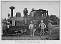 Mota na farko a kasar Togo
 -
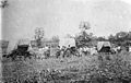
 Wani Manomi a kasar Togo
 -
 Jama'a a kasar Togo a yayin tafiya
 -
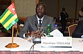 ministan tsaron kasar Togo a shekara ta 2018
 -
 kudin kasar togo

.jpg)
.jpg)
.jpg)


| |
|---|---|
|
Aljeri | Anngolaa | Benen | Boosuwaana/Botswana | Burkina Faso | Burunndi | Eritereya | Gabon | Gammbi | Gana | Gine | Gine-Biso/Gine-Bisaawo | Gine Ekwatoriyal | Kamerun | Kapu Werde | Kenya | Kodduwaar | Labiriya/Labiriyaa | Maali | Mozammbik | Muritani | Namibiya | Niiser | Niiseriya | Sarliyon | Senegaal | Somaaliya | Togo | |